
Forget the official TTC map; surviving Toronto’s transit system is about mastering its unwritten rules and inherent chaos.
- Your monthly pass might be a waste of money, and free transfers with GO Transit have changed the entire game.
- “Real-time” transit apps lie. Learning to spot “ghost buses” is a non-negotiable survival skill.
- Navigating the PATH isn’t about following signs, it’s about memorizing anchor buildings to avoid getting lost.
Recommendation: Stop trying to make the TTC work logically. Instead, learn to anticipate its failures and exploit its loopholes to make your commute bearable.
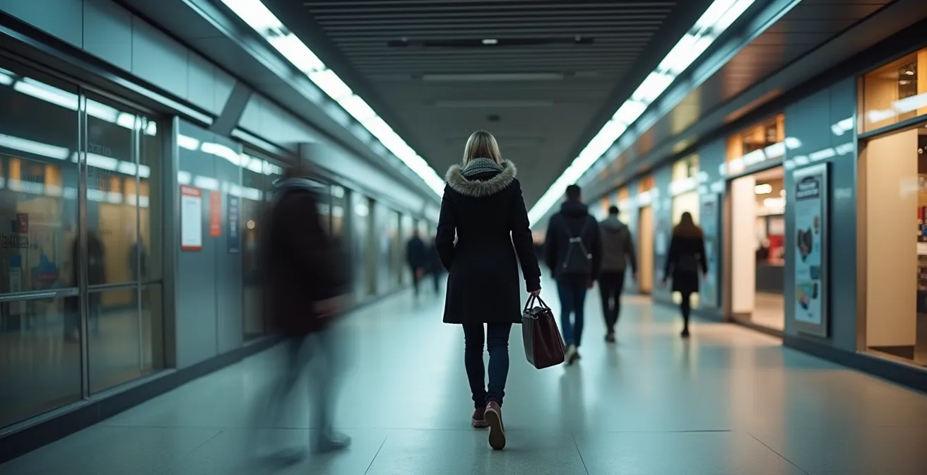
Welcome to Toronto. You’ve probably been sold a dream of a world-class city with seamless public transit. Now, the grim reality of a delayed streetcar in a blizzard is setting in. The official advice you’ve received—”get a PRESTO card,” “plan your route”—is well-meaning but hopelessly naive. It doesn’t prepare you for a bus that vanishes from the map, a “short turn” that dumps you miles from your destination in -10°C weather, or a simple payment mistake that could cost you hundreds of dollars.
Surviving the Toronto Transit Commission (TTC) isn’t about following the colour-coded lines on a map. It’s a game of defensive commuting. It requires a cynical but strategic mindset, one that accepts the system’s flaws and learns to predict them. This is not a guide on how the TTC is *supposed* to work. This is a guide on how it *actually* works, built on the hard-won wisdom of veteran commuters. We’re going to ignore the platitudes and focus on the unwritten rules of survival.
Instead of just telling you to buy a pass, we’ll analyze if it’s a financial trap. Instead of telling you to use an app, we’ll teach you how to read between the lines to spot the infamous “ghost bus.” From leveraging the GO Train to your advantage to navigating the labyrinthine PATH system without a map, you’ll learn to treat the network not as a service, but as a complex, often illogical, system to be hacked. This is your real introduction to getting around Toronto.
This guide breaks down the essential survival tactics you won’t find on the official website. Below is a summary of the key strategies we will cover to transform you from a frustrated newcomer into a savvy Torontonian commuter.
Summary: Your Guide to Mastering Toronto’s Transit Chaos
- Why Is the Metropass Only Worth It If You Ride 40+ Times?
- How to Use Transit Apps to Predict Ghost Buses?
- Blue Night Network vs. Uber: Which Is Safer for Late Shifts?
- The Proof-of-Payment Mistake That Costs Riders $425 CAD
- When to Use the GO Train Instead of the Subway for Downtown Travel?
- Why Do Short Turns Leave You Stranded in -10°C Weather?
- How to Walk from Union Station to the Eaton Centre Entirely Indoors?
- How to Navigate the PATH Underground System Without Losing 20 Minutes?
Why Is the Metropass Only Worth It If You Ride 40+ Times?
The first piece of conventional wisdom you’ll hear is to buy a monthly pass for unlimited travel. It sounds convenient, but for many, it’s a financial misstep. The math is stark: the pass only becomes cost-effective after a significant number of trips. A recent TTC fare analysis reveals a rider needs to make around 47 trips per month to break even on the $156 monthly cost compared to paying per ride. That’s more than a twice-daily commute, five days a week. If you work from home a few days, take a vacation, or simply walk on a nice day, you’re likely losing money.
The calculation gets even more complex with the introduction of the One Fare Program in early 2024. This program allows free transfers between the TTC and surrounding regional transit systems like GO Transit, MiWay, and York Region Transit when using your PRESTO card. Previously, a commuter from the 905 area paid separate fares for each leg of their journey. Now, that transfer is free.
This fundamentally changes the value proposition. Someone commuting from Liberty Village to the Financial District might now find it faster and, more importantly, free to hop on the GO Train for one stop instead of a crowded streetcar, as the transfer to the TTC is covered. The monthly pass, which was once a tool of convenience, now looks rigid and overpriced compared to the flexibility of a pay-as-you-go PRESTO card that can be used for strategic system arbitrage between different transit agencies.
How to Use Transit Apps to Predict Ghost Buses?
There is no greater torment for a Toronto commuter than the “ghost bus.” This is the bus or streetcar that appears on your real-time tracking app, its icon inching closer, only to vanish into thin air a block away, leaving you stranded. These are not technical glitches; they are often the result of vehicles being taken out of service or short-turned without the data feed being updated immediately. Relying solely on the scheduled time is a rookie mistake; relying blindly on the live map is a recipe for frustration.
To survive, you must learn to be a transit detective, scrutinizing the app for signs of impending doom. The key is to look for patterns beyond the single icon on the map. Is the app showing the vehicle as “Live” or just displaying its scheduled time? A scheduled time without a live indicator is highly unreliable. Another major red flag is bus bunching, where the map shows two or three buses clustered together. This often precedes a short turn, where the first bus will turn back to fix a gap in service elsewhere, leaving you waiting for the next one.
If a bus that was tracking live suddenly disappears from the map, don’t hold out hope. It’s gone. Consider it a ghost and immediately start looking for your Plan B route. Cross-referencing the live map with the official service alerts section of your app can also provide clues about disruptions that might lead to ghost buses. Mastering this cynical art of app interpretation is the difference between a minor inconvenience and a frozen, hour-long wait.
Your Action Plan: Verifying a Real-Time Bus Location
- Check the app: Open a trusted app like Transit, which uses the TTC’s real-time data for all 205 bus lines.
- Look for the ‘Live’ indicator: Confirm the bus icon shows a live data feed, not just a scheduled time.
- Spot bunching patterns: Watch for 2-3 buses clustered together, a strong indicator of a potential short turn.
- Cross-reference alerts: Quickly check the app’s service alerts for any known disruptions or delays on your specific route.
- Confirm the ghost: If a previously live vehicle’s real-time data suddenly vanishes, accept it as a ghost bus and switch to your backup plan.
Blue Night Network vs. Uber: Which Is Safer for Late Shifts?
For those working late shifts or enjoying Toronto’s nightlife, the journey home presents a classic dilemma: the affordable but infrequent Blue Night bus or the expensive but direct Uber? The TTC’s Blue Night Network is extensive, and the official promise is that the Blue Night Network operates with service every 30 minutes or less from roughly 1:30 a.m. to 5 a.m. In reality, a 30-minute wait on a deserted street corner in the middle of the night can feel like an eternity and raises valid safety concerns, especially for solo travelers.
While an Uber or Lyft offers door-to-door service, the cost can be prohibitive, especially with surge pricing after last call. However, the TTC has safety measures that many newcomers are unaware of, which can tip the balance. The most important is the Request Stop program. Between 9 p.m. and 5 a.m., any passenger feeling vulnerable can ask the bus driver to let them off between regular stops, closer to their home or a well-lit area. This significantly reduces the time spent walking alone at night.
Furthermore, the SafeTTC app allows for discreet reporting of any harassment or safety concerns directly to Transit Control. When you combine the Request Stop feature with a well-planned route, the Blue Night bus becomes a much safer and more viable option than many believe. The decision ultimately comes down to a personal calculation of risk, cost, and convenience. But dismissing the TTC’s late-night service without knowing about these built-in safety features is a mistake.
The Proof-of-Payment Mistake That Costs Riders $425 CAD
On the TTC, paying your fare is only half the battle. The other half is being able to *prove* you paid, a stressful performance known as fare compliance theatre. On subways, this is simple—you can’t get in without tapping your PRESTO card. But on streetcars and buses, where you can board through any door, the onus is on you to have valid Proof-of-Payment (POP) at all times. Failure to produce it for a fare inspector can result in a staggering $425 fine.
The most common mistake is simple complacency. You tap your card but put it away, or you pay with cash on a streetcar and forget to take the paper transfer from the machine. Your tapped PRESTO card, credit card, or valid paper transfer *is* your proof. If a fare inspector boards and you can’t produce it immediately, excuses are rarely accepted. Another pitfall is tapping twice within the two-hour transfer window, which can accidentally start a new fare and void your transfer. If a card reader is broken, you must immediately inform the driver; otherwise, you have no proof you attempted to pay.

This system can feel particularly punitive, especially as the TTC phases out older forms of payment. While most people use PRESTO, the TTC estimates that millions of old tokens and tickets are still in circulation, adding to potential confusion. The rules are rigid: always tap when you enter a station or vehicle, get a paper transfer if paying by cash on a surface route, and keep your POP easily accessible until you exit the system. Don’t let a moment of forgetfulness turn your $3.30 ride into a $425 lesson.
When to Use the GO Train Instead of the Subway for Downtown Travel?
Most newcomers see the TTC and GO Transit as two separate worlds: the TTC for getting around Toronto, and the GO Train for commuting from the suburbs. A true Torontonian knows this is a false distinction and that using the GO Train for short trips *within* the city is one of the most effective transit hacks available. This is the art of system arbitrage: choosing the faster, more comfortable, and sometimes cheaper option, even if it feels counter-intuitive.
For certain routes, the time savings are dramatic. A trip on the notoriously crowded 504 King streetcar from Exhibition Place to Union Station can take 20 minutes or more in traffic. The same journey on the GO Train takes a mere 3 minutes. With the launch of the One Fare Program, the cost barrier has been eliminated. A trip that involves a GO and TTC leg within the transfer window means you only pay the single highest fare—usually the GO portion—making the TTC part of the journey free.
The table below highlights just how much more efficient the GO Train can be for key crosstown routes, especially for those living near a GO station in areas like Liberty Village or the Danforth. While GO trains run less frequently than the subway during off-peak hours, the trade-off in speed, comfort, and predictability is often worth it.
| Route | TTC Time | GO Train Time | GO Frequency | Cost Difference |
|---|---|---|---|---|
| Exhibition to Union | 15-20 min (504 streetcar) | 3 minutes | Every 15 min peak | Free with One Fare |
| Danforth to Union | 20 min (Line 2 + transfer) | 7 minutes | Every 30 min | Free with One Fare |
| Liberty Village to Financial District | 25-35 min (504 King) | 8 minutes total (with walk) | Every 15-30 min | Free with One Fare |
Why Do Short Turns Leave You Stranded in -10°C Weather?
The “short turn” is perhaps the most infuriating and uniquely Toronto transit experience. You’re on a streetcar, minutes from your stop, when the driver announces the vehicle is “turning back to regulate service.” Everyone is ordered off, often into the freezing cold, to wait for the next, now doubly-crowded, vehicle. Officially, short turns are a tool to manage large, unexpected gaps in service caused by things like vehicle breakdowns, traffic jams, or police investigations. The goal is to send a vehicle back to fill a hole in the schedule further down the line.
The TTC itself points to the constant need for maintenance as a source of disruption. As a news release on Transit Toronto notes:
While the TTC does most subway maintenance after service each night, it continues to require weekend and early weeknight closures to complete critical infrastructure and state-of-good-repair work
– TTC News Release, Transit Toronto Service Update
While this explains weekend closures, it doesn’t fully capture the daily, chaotic reality for surface routes. For the commuter, the “why” is less important than the “how to survive.” The first rule of short turn survival is to anticipate them. They frequently happen at designated turnaround points (like Roncesvalles for the 504 King or St. Clair West Station for the 512 St. Clair). If you see buses bunching on your app, a short turn is likely imminent. If possible, position yourself at a stop just *before* a known turnaround point. Even better, always have a Plan B in mind: know which alternate bus or streetcar routes serve your area so you can quickly pivot when you get kicked off.
How to Walk from Union Station to the Eaton Centre Entirely Indoors?
One of the greatest survival tools for a downtown commuter in Toronto is the PATH, a sprawling underground network of tunnels connecting major buildings. Its greatest promise is the ability to traverse the core in the dead of winter or a sweltering summer day without ever stepping outside. A classic PATH challenge for newcomers is the trek from Union Station, the city’s main transit hub, to the Eaton Centre, its largest shopping mall. Doing it above ground is a miserable experience in bad weather. Doing it underground is a masterclass in efficiency, if you know the way.
The route isn’t entirely straightforward, as you’re passing through several privately owned buildings. Here is the most direct path:
- Exit the main Union Station concourse and head towards the GO Bay Concourse. Look for escalators with signs pointing towards the TD Bank Tower.
- Walk through the TD Centre’s food court. The key here is to follow the overhead signs for the Sheraton Centre hotel.
- You will pass through the Sheraton Centre’s main lobby. Continue straight through to reach the pedestrian connection bridge on the other side.
- This bridge connects you to Hudson’s Bay/Saks Fifth Avenue. Take this final bridge, and it will deposit you directly inside the south end of the Eaton Centre.
There is also an accessible route that uses elevators at each building transition, though it can add about five minutes to the journey. Mastering this specific route is a rite of passage. It not only saves you from the elements but also provides a sense of control and insider knowledge that is crucial for feeling at home in the city’s downtown core.
Key takeaways
- Stop trusting the system: Assume apps are delayed, passes are poor value, and disruptions are the norm.
- Become a system hacker: Learn to use GO Transit for short hops, the PATH to bypass weather, and app data to predict failures.
- Know the hidden rules: Master a few key tactics like the Request Stop program and the Anchor Building navigation method to gain a massive advantage.
How to Navigate the PATH Underground System Without Losing 20 Minutes?
You’ve learned the specific route from Union to the Eaton Centre, but what about navigating the entire 30-kilometre PATH system? The official color-coded wayfinding signs are notoriously confusing. They are inconsistent because the PATH isn’t one system; it’s a series of interconnected basements belonging to over 30 different private buildings. Following the signs is how you get turned around and lose 20 minutes trying to find an exit.
The veteran commuter’s secret to the PATH is to ignore the signs completely. Instead, they use the Anchor Building Navigation Method. This involves creating a mental map of a half-dozen major, unmissable buildings that act as landmarks. These are typically: Scotiabank Arena, Union Station, TD Centre, Scotia Plaza, First Canadian Place, the Sheraton Centre, and the Eaton Centre. By navigating from one anchor building to the next, you maintain your bearings far more effectively than by trying to decipher a sign that points “west” down a corridor that is clearly heading north.
This mental mapping approach turns a confusing labyrinth into a series of simple, point-to-point journeys. It’s the ultimate “unwritten rule” of downtown navigation. It embodies the core philosophy of this guide: don’t trust the provided system. Instead, observe the underlying structure, find the loopholes and landmarks, and build your own, more reliable system on top of it. This mindset is what separates the perpetually lost tourist from the true Torontonian who can glide through the city’s chaos with cynical confidence.
Now that you’re armed with these survival tactics, the next step is to consciously apply this cynical, strategic mindset to every trip you take.
Frequently Asked Questions about Navigating the PATH
Why do PATH hours vary by section?
Each building sets its own hours since PATH connects private properties. Most financial district sections close by 6 PM weekdays, and even earlier on weekends.
Which PATH routes stay open latest?
The connection between Union Station and Scotiabank Arena remains open late during events. Connections through major hotels like the Sheraton or Hilton also typically stay open until at least 11 PM.
Are north-south signs more reliable than east-west?
Yes, due to Toronto’s grid system alignment, the north-south directional signs in the PATH tend to be more consistent and easier to follow than the east-west indicators, which can often be misleading as corridors twist and turn.